
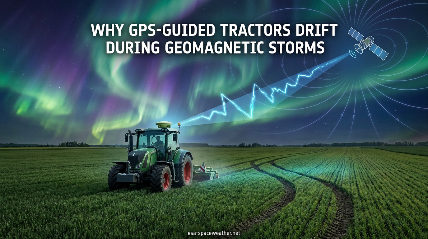
On the night of May 10, 2024, farmers across the American Midwest looked up and saw something breathtaking. The aurora borealis painted the sky in vivid reds and greens, visible as far south as Florida and Texas. But the same cosmic spectacle that lit up the heavens was quietly wreaking havoc on the ground. GPS-guided tractors from Minnesota to Nebraska suddenly veered off course, planted crooked rows, or shut down entirely — leaving farmers stranded at the height of spring planting season.
If you have ever wondered why farmers’ GPS-guided tractors drift during geomagnetic storms, the answer lies 60 miles above your head. A layer of charged particles called the ionosphere surrounds our planet, and during a solar storm, that layer becomes turbulent and unpredictable. The radio signals that GPS satellites beam down to tractors pass through this layer — and when the layer churns, the signals bend, scatter, and arrive late.
In this article, I will walk you through exactly what happens when a geomagnetic storm hits, why precision agriculture systems are especially vulnerable, and what farmers can do to protect their operations. I have spent years tracking space weather events and their real-world impacts, and the farming community’s experience during Solar Cycle 25 is one of the most striking examples of how space weather touches daily life on Earth.
Table of Contents
The Short Answer: How Geomagnetic Storms Disrupt Tractor GPS
Geomagnetic storms disrupt GPS-guided tractors by disturbing the ionosphere — the upper layer of Earth’s atmosphere filled with electrically charged particles. When a coronal mass ejection (CME) from the sun slams into Earth’s magnetic field, it dumps enormous amounts of energy into the ionosphere. This energy creates plasma bubbles, density waves, and turbulence that distort the radio signals GPS satellites send to receivers on farm equipment.
The result is predictable: tractor GPS systems cannot calculate accurate positions. Auto-steer systems lose their lock and “dance” left or right. RTK correction signals deliver “bad corrections” that place tractors several feet from where they should be. In severe cases like the May 2024 G5 storm, GPS receivers cannot lock onto satellites at all, bringing planting operations to a complete halt.
How Modern Farming Depends on GPS-Guided Tractors
To understand why a GPS outage is so devastating, you need to understand how deeply precision agriculture has penetrated modern farming. Over 80 percent of large-scale farms in the US Midwest now use some form of GPS-guided equipment. Auto-steer systems let tractors plant perfectly straight rows across thousand-acre fields, even in darkness or low-visibility conditions.
The accuracy requirements are astonishing. Strip-till farmers — who prepare narrow bands of soil for planting while leaving the rest of the field undisturbed — need their GPS systems to be accurate within one inch. The planter must follow exactly in the tracks left by the strip-till implement. Any drift means seeds land outside the prepared zone, reducing germination rates and yield.
GPS guidance also controls seed spacing, fertilizer application rates, and spray patterns. When the GPS signal is reliable, farmers save fuel, reduce seed waste, minimize chemical overlap, and maximize yield per acre. When the signal fails, every one of those benefits reverses instantly.
Systems like John Deere’s AutoPath take this a step further by storing historical guidance lines across multiple seasons. Farmers can retrace the exact same wheel tracks year after year, a practice called controlled traffic farming that preserves soil structure and reduces compaction. But when a storm corrupts the GPS data during a pass, those stored lines can become contaminated with errors that persist into future seasons.
What Happens to the Ionosphere During a Geomagnetic Storm
The ionosphere is a layer of Earth’s upper atmosphere sitting roughly 37 to 620 miles above the surface. It contains a high concentration of ions and free electrons — atoms that have been stripped of electrons by ultraviolet radiation and X-rays from the sun. Under normal conditions, this charged layer is relatively stable and predictable.
GPS satellites orbit at about 12,550 miles above Earth. Every signal they send to a GPS receiver on a tractor must pass through the ionosphere. In fact, the ionosphere is the single largest source of positioning error in standard GPS. GPS receiver software compensates for typical ionospheric delay using mathematical models — and under calm conditions, those models work well enough to achieve sub-meter accuracy.
A geomagnetic storm changes everything. When a CME — a massive burst of solar plasma and magnetic field — reaches Earth, it compresses the magnetosphere and dumps enormous energy into the ionosphere. The Total Electron Count (TEC), a measure of electron density along the signal path, can spike dramatically within minutes.
This TC increase does not happen evenly. The ionosphere develops dense plasma bubbles, large-scale traveling ionospheric disturbances (TIDs), and small-scale irregularities that cause a phenomenon called ionospheric scintillation. Scintillation makes GPS signals flicker in strength, like a star twinkling in the night sky. The signals scatter, refract, and arrive at the tractor’s receiver at slightly different times than expected.
The effect is most severe at high latitudes — which is why farmers in Minnesota, North Dakota, and Canada experienced some of the worst disruption during the May 2024 storm. Equatorial regions can also be affected by plasma bubbles that form near the magnetic equator, though through a slightly different mechanism.
Why Farmers’ GPS-Guided Tractors Drift During Geomagnetic Storms: The Physics Step by Step
Let me break down the exact chain of events that turns a solar storm into crooked rows in a cornfield.
Step 1: The Sun Erupts. A sunspot region releases a coronal mass ejection — a billion-ton cloud of charged plasma traveling at speeds up to 3 million miles per hour. If Earth is in the path, the CME arrives in 15 to 48 hours.
Step 2: The Magnetosphere Compresses. When the CME’s magnetic field interacts with Earth’s magnetosphere, it triggers a geomagnetic storm. The NOAA Space Weather Prediction Center classifies these storms on a G1 (minor) to G5 (extreme) scale based on the Kp index, a measure of geomagnetic disturbance.
Step 3: The Ionosphere Heats Up. Charged particles funnel into the polar regions, heating the ionosphere and dramatically increasing the Total Electron Count. This creates the visible aurora — but it also creates invisible chaos in the radio-frequency environment.
Step 4: GPS Signals Distort. As GPS satellite signals pass through the turbulent ionosphere, they encounter rapidly varying electron densities. The signals bend, slow down, and scatter. Some signals are delayed by several additional nanoseconds compared to what the receiver expects.
Step 5: Position Calculations Break. GPS receivers calculate position by measuring the time it takes for signals to arrive from at least four satellites. If those signals arrive late or scattered, the receiver’s position math goes wrong. The error can range from a few inches to several feet — and it can change from second to second as the ionosphere churns.
Step 6: Auto-Steer Reacts. The tractor’s auto-steer system receives these fluctuating position updates and tries to correct. The tractor suddenly thinks it is two feet left of the guidance line, so it steers right. Then the error flips, and it steers left. Farmers describe this as the tractor “dancing” or “juking” back and forth across the row.
Step 7: RTK Corrections Corrupt. For RTK users, the problem compounds. The base station sends correction data to the rover (tractor) based on its own GPS measurements. But if the base station’s signals are also distorted by the ionosphere, it sends “bad corrections” that actually make the tractor’s position worse instead of better.
This is exactly what happened during the May 2024 G5 storm. The ionosphere was so disturbed that many RTK systems could not distinguish good data from bad data, and the entire correction chain collapsed.
RTK vs Standard GPS: Which Is More Vulnerable
Here is a question that confuses a lot of farmers: is RTK (Real-Time Kinematic) GPS more or less vulnerable to geomagnetic storms than standard GPS? The answer is nuanced but important.
Standard GPS provides accuracy of about 3 to 10 feet. It uses a single frequency from each satellite and applies a general ionospheric model to correct for signal delay. During a storm, standard GPS degrades — but since its baseline accuracy is already relatively low, the additional error is proportionally less catastrophic.
RTK GPS is a different story. Under normal conditions, RTK achieves accuracy of one inch or less by using a fixed base station that sends real-time corrections to the tractor’s receiver. This eliminates most atmospheric errors and delivers the pinpoint precision that strip-till and no-till farmers depend on. John Deere’s RTK system uses StarFire receivers — the StarFire 3000 and the newer StarFire 6000 — paired with either a local base station or a cellular-delivered correction network.
During a geomagnetic storm, RTK’s advantage becomes its Achilles’ heel. The system’s entire correction model assumes that the ionosphere is relatively stable between the base station and the rover. When the ionosphere is rapidly fluctuating, that assumption fails. The base station measures one set of ionospheric conditions, but by the time the correction reaches the tractor, the ionosphere has already changed. The “correction” is based on outdated data and actually introduces new errors.
This is why John Deere dealerships like LandMark Equipment sent advisories to their customers during the May 2024 storm warning them that RTK accuracy could not be guaranteed. The problem was not that the equipment was broken — it was that the mathematical assumptions underlying the correction system no longer held true.
In practice, RTK users tend to notice GPS drift more dramatically because their expectations are higher. A standard GPS user might accept three feet of drift as tolerable, but an RTK user who needs one-inch accuracy cannot tolerate even six inches of error.
Real Farmer Experiences: Crooked Rows and Stalled Tractors
The most compelling evidence of how geomagnetic storms affect precision agriculture comes from the farmers themselves. Their stories from the May 2024 and October 2024 storms paint a vivid picture of what happens when space weather meets planting season.
Elaine Ramstad, a farmer in northern Minnesota, was defoliating sugar beets on the night of May 10, 2024, when the G5 storm hit. She described her GPS drifting by close to a foot, with the tractor’s auto-steer system lurching unpredictably. “Twice while on Autosteer, the tractor danced a row to the left, to the right — and then the defoliator was off a row, so I had to loop around and start over,” she told Spaceweather.com. By nightfall, there was no controlling the auto-steer at all.
Kevin Kenney, a farmer in Nebraska, gave one of the most widely shared accounts of the storm’s impact. Speaking to 404 Media, he described the scene: “All the tractors are sitting at the ends of the field right now shut down because of the solar storm. No GPS. We’re right in the middle of corn planting.” For farmers operating within a narrow planting window dictated by soil temperature and weather, losing even one night of planting time can mean reduced yields at harvest.
Patrick O’Connor, farming 80 miles south of Minneapolis, had never experienced anything like it. He called his equipment dealer’s technical help line and was directed to a recorded message saying there was a GPS outage and nothing could be done. The helplessness was frustrating — the technology he relied on every day had been rendered useless by something happening 93 million miles away.
Michael Spencer, an Indiana farmer, experienced similar problems during the October 2024 G3/G4 storms. “When the storms were strongest around October 7th, my tractor’s Autosteer system would jump the line — meaning the tractor would make a quick jolt left or right and I would have to manually reset,” he reported. Even moderate geomagnetic storms, it turns out, can cause significant disruption to auto-steer systems.
On Reddit’s r/farming community, a strip-till farmer described the fundamental problem: “We’re strip-till farmers so in order for the planter to follow the strip tiller we need 1-inch accuracy. Wasn’t happening.” That single sentence captures the entire crisis — when your farming system is built around one-inch precision and your GPS suddenly cannot deliver it, the entire workflow collapses.
The October 2024 storms reinforced that the May event was not a one-time fluke. Farmers who had manually reset their John Deere auto-steer systems repeatedly during those fall storms realized they needed to take solar weather seriously as an ongoing operational risk, not a rare curiosity.
Storm Severity Levels and GPS Impact
The NOAA Space Weather Prediction Center uses a five-level scale to classify geomagnetic storms, from G1 (minor) to G5 (extreme). Each level corresponds to a Kp index value, which measures geomagnetic disturbance on a scale of 0 to 9. Understanding this scale helps farmers anticipate how bad GPS disruption might get.
A G1 storm (Kp 5) may cause minor GPS degradation, with accuracy dropping by a few inches. Most farmers would not notice. A G2 storm (Kp 6) can produce noticeable drift in precision agriculture systems, especially at higher latitudes. RTK users near the northern tier of US states might see accuracy degrade from one inch to several inches.
A G3 storm (Kp 7) is where problems become serious. Auto-steer systems may start to “jump” and require manual resets. The October 2024 storms reached G3 to G4 levels and caused significant disruption for Midwest farmers during fall fieldwork. A G4 storm (Kp 8) can take RTK systems largely offline, with accuracy losses of a foot or more. Standard GPS users will see errors of 10 to 30 feet.
A G5 storm (Kp 9) is the worst case. The May 2024 event was the first G5 storm since the Halloween Storms of 2003. At this level, GPS accuracy across all systems is severely compromised. Many receivers cannot maintain a satellite lock at all, and RTK correction networks become unreliable across wide areas. Farmers in Minnesota, Wisconsin, Iowa, Nebraska, and the Dakotas reported complete GPS outages lasting several hours.
Solar Maximum 2025-2026: What Farmers Should Expect
If the May 2024 and October 2024 storms felt like a warning shot, that is because they were. Solar Cycle 25 has been significantly more active than forecasters initially predicted, and we are now in the Solar Maximum period that NASA and NOAA project will extend through late 2025 and into 2026.
The solar cycle follows an approximately 11-year pattern of rising and falling sunspot activity. During Solar Maximum, the sun produces more sunspots, more solar flares, and more coronal mass ejections — all of which increase the frequency and intensity of geomagnetic storms at Earth. This means farmers should expect more G3, G4, and potentially G5 storms during spring planting and fall harvest seasons for the next couple of years.
The historical comparison is sobering. The last comparable Solar Maximum was in 2001-2002, culminating in the infamous Halloween Storms of October 2003. At that time, GPS-guided precision agriculture was far less widespread than it is today. The May 2024 storm was essentially the first G5 event to hit a farming sector that is now deeply dependent on centimeter-level GPS accuracy.
NASA’s Solar Maximum forecast suggests that solar activity will remain elevated through 2025 and may not decline significantly until 2026 or 2027. Farmers should plan for at least one or two more planting seasons where geomagnetic storms are a realistic operational risk.
What Farmers Can Do: Mitigation and Preparedness
The good news is that farmers are not helpless when it comes to space weather. Several practical strategies can reduce the impact of geomagnetic storms on precision agriculture operations.
1. Monitor Space Weather Forecasts. The NOAA Space Weather Prediction Center (swpc.noaa.gov) provides free forecasts and alerts for geomagnetic storms. Farmers can sign up for email or text alerts that warn of incoming CME impacts hours or even days in advance. When a G3 or higher storm is forecast, farmers can adjust their plans — prioritizing fields where GPS accuracy is less critical, or scheduling non-GPS-dependent tasks during the storm window.
2. Understand the Kp Index. Learning to read the Kp index is one of the most practical skills a farmer can develop. If the Kp forecast shows values of 6 or higher for your region, expect GPS degradation. Kp 7 or above means you should have a backup plan for the next 6 to 12 hours.
3. Invest in Dual-Frequency Receivers. Dual-frequency GPS receivers, which track signals on two different frequency bands (L1 and L2), can directly measure ionospheric delay and remove much of the error that single-frequency receivers suffer from. While more expensive, they offer significantly better performance during moderate geomagnetic storms. The John Deere StarFire 6000 is a dual-frequency receiver, making it more resilient than the older StarFire 3000.
4. Use Multi-Constellation Navigation. Modern receivers can track signals from multiple satellite constellations — GPS (US), GLONASS (Russia), Galileo (Europe), and BeiDou (China). Using multiple constellations increases the number of satellites visible at any time, which improves position accuracy and helps the receiver identify and reject corrupted signals. Some newer agricultural GPS systems support multi-constellation tracking out of the box.
5. Have a Manual Fallback Plan. During a severe storm, the safest option may be to shut down GPS-guided operations entirely. Farmers should know how to switch their auto-steer systems to manual mode and be prepared to drive rows by sight or using older mechanical guidance systems. This is especially important for time-sensitive operations like planting, where waiting out a storm is not always an option.
6. Check GPS Accuracy Before Committing. Before starting a critical pass across a field, farmers can verify GPS accuracy by stopping at a known reference point (like a fence post or field corner) and checking whether the displayed position matches. If the position is jumping or drifting noticeably, it is better to pause operations than to plant crooked rows that will need to be redone.
7. Preserve Historical Guidance Lines. If you use AutoPath or a similar multi-season guidance system, be careful during storm periods. A corrupted pass can contaminate your stored guidance lines, creating problems that persist long after the storm passes. Some farmers recommend marking any fieldwork done during a storm event so those passes can be excluded from the historical database.
FAQs
Does a geomagnetic storm affect GPS?
Yes. Geomagnetic storms disturb the ionosphere, increasing electron density and creating turbulence that distorts GPS radio signals. This causes position errors ranging from a few inches during minor storms to complete signal loss during G5 extreme storms. Precision agriculture systems that require centimeter-level accuracy are the most affected.
How accurate are farmer GPS systems?
Standard agricultural GPS provides accuracy of about 3 to 10 feet. WAAS-corrected GPS improves this to about 1 to 2 feet. RTK (Real-Time Kinematic) GPS systems, which use a fixed base station to send real-time corrections, achieve accuracy of one inch or less. Strip-till and no-till farmers typically require this one-inch precision for their equipment to function correctly.
Which technology is most affected by geomagnetic storms?
RTK GPS systems used in precision agriculture are among the most affected technologies because they depend on the ionosphere being stable between the base station and the rover. When the ionosphere becomes turbulent during a storm, the correction data becomes unreliable. Other affected technologies include standard GPS navigation, satellite communications, and high-frequency radio systems.
How long do GPS outages last during geomagnetic storms?
GPS disruptions during geomagnetic storms typically last 6 to 24 hours, depending on storm severity. The worst effects occur during the peak of the storm, with gradual recovery as the ionosphere stabilizes. The May 2024 G5 storm caused GPS problems for most of a single night, with conditions improving significantly by the following morning.
Can farmers get alerts before a solar storm hits?
Yes. The NOAA Space Weather Prediction Center offers free email and text alerts for geomagnetic storms, often providing 12 to 48 hours of advance warning. Farmers can also check the Kp index forecast on the SWPC website to anticipate GPS degradation. Subscribing to these alerts is the single most effective step a farmer can take to prepare for space weather impacts.
Are solar storms getting more frequent?
Solar storm frequency follows an approximately 11-year cycle. We are currently in Solar Maximum for Solar Cycle 25, which means increased sunspot activity, more coronal mass ejections, and more geomagnetic storms through late 2025 and into 2026. After Solar Maximum, storm frequency will gradually decline over the next several years toward the next solar minimum.
Conclusion
Understanding why farmers’ GPS-guided tractors drift during geomagnetic storms comes down to a simple chain: the sun erupts, the ionosphere churns, GPS signals distort, and precision agriculture systems lose their accuracy. For farmers who depend on one-inch precision to plant straight rows, manage inputs, and maximize yield, even a few hours of GPS disruption during planting season can have real economic consequences.
The May 2024 G5 storm and the October 2024 G3/G4 storms demonstrated that this is not a theoretical risk — it is a recurring operational challenge that will continue through Solar Maximum in 2026. The farmers who fare best will be those who monitor space weather forecasts, understand the Kp index, invest in resilient GPS technology like dual-frequency receivers, and maintain manual fallback plans for when the aurora lights up the sky.
Space weather is not going away, and neither is precision agriculture. The key is awareness, preparation, and the right tools. By signing up for NOAA SWPC alerts and understanding how storm severity maps to GPS accuracy loss, farmers can turn an invisible threat into a manageable part of their operational planning.